Asset Publisher
Importing entities to a graphic layer using GeoCSV files (Attributes + WKT Geometry)
No doubt many times In your CartoDruid projects, you need to add new entities that you already have in another format. These entities can be included in your layer using the GeoCSV import feature of CartoDruid.
In order to do this, we must have a GeoCSV file (Attributes + WKT Geometry) generated with the same fields and in the same order as our project layer.
Let's suppose your entities are stored in a Shapefile (SHP), you can create your GeoCSV file follows:
-
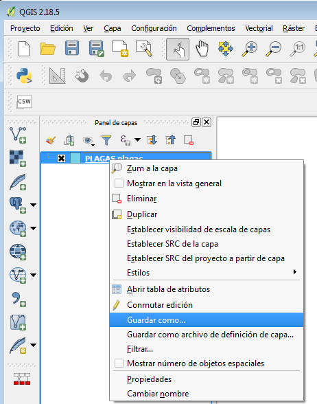
You load the graphic layer SHP in QGIS, and by clicking with the right button of the mouse on the layer, the option "Save as..." will be selected.
-
Below we show you the necessary options to create a file of this type in QGIS (2.18 or higher), they are highlighted in the red boxes of the image:
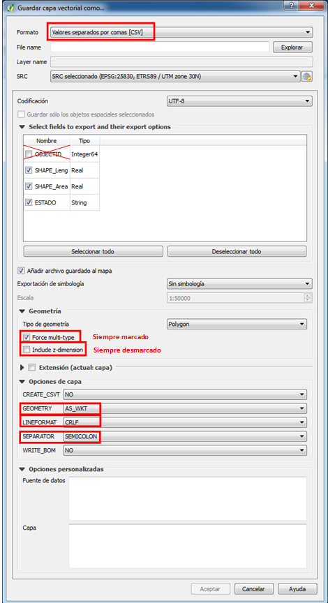
The generated file is a text file with the ".CSV" extension, in which the geometry will be described in WKT format, which CartoDroid, when using the entity import option, will interpret and incorporate into corresonding geographic table.


It should be noted that to carry out this load, the created CSV must already be in the device and must have the same fields and in the same order as the existing one. Otherwise, the missing or non-corresponding fields between the external data in GeoCSV and the CartoDroid layer will be left unfilled or will end up in different fields, what would cause errors in the import process.
CartoDruid has several options to import entities, one of them we have already seen in another article "Create a new layer starting from a list of SigPac enclosures", in this case you would choose the second option "Import graphic entities from CSV file (Attributes + Geometry in WKT)".


